This page is subject to the extended confirmed restriction related to the Arab-Israeli conflict.
Municipality type C in Ramallah and al-Bireh, State of Palestine
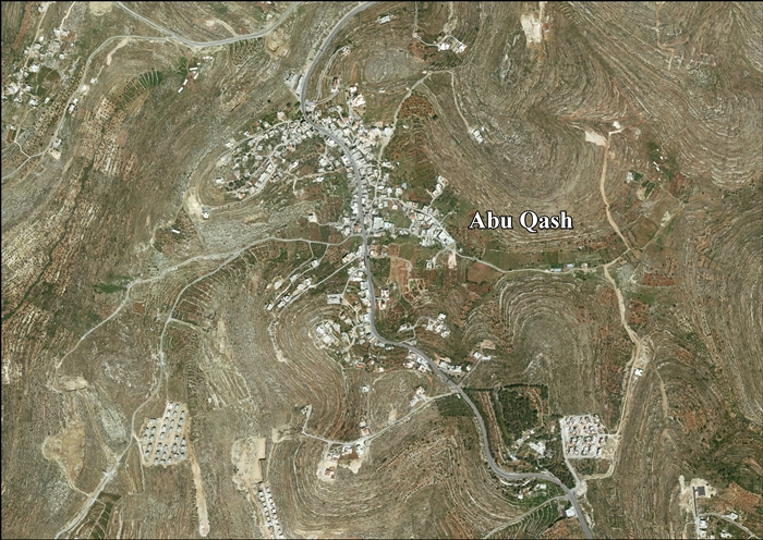
Abu Qash (Arabic : ابو قش ) is a Palestinian village located in the Ramallah and al-Bireh Governorate in the northern West Bank , located north of Ramallah and south of the Birzeit University . According to the 2017 census conducted by the Palestinian Central Bureau of Statistics , it had a population of 2,237.[ 1]
Location
Abu Qash is located 5.3 kilometers (3.3 mi) north of Ramallah . It is bordered by Surda and Jifna to the east, Bir Zeit to the north, Al-Zaytouneh and Ramallah to the west, and by Ramallah and Surda to the south.[ 3]
History
Abu Qash was founded in the Ottoman period by settlers from Beitunia during the Qays–Yaman war .[ 4]
Earlier remains found at the site include two tombs dating to the Byzantine period,[ 5] Mamluk eras.[ 5]
Ottoman era
Sherds from the early Ottoman era have also been found here.[ 5] Edward Robinson as a Muslim village, Abu Kush , in Beni Harith district, north of Jerusalem.[ 6]
In 1863 Victor Guérin noted it as "A hamlet of about twenty houses, situated on a high hill, the slopes of which are partly covered with vines, olive trees and fig trees."[ 7]
An Ottoman village list of about 1870 indicated that the village had 25 houses and a population of 78, though the population count included men, only. It was further noted that it was located just west of Surda .[ 8] [ 9]
In 1882 the PEF 's Survey of Western Palestine hamlet , with a well on the north, on an ancient road, with a few olives near."[ 10]
In 1896 the population of Abu Kusch was estimated to be about 204 persons.[ 11]
British Mandate era
Agricultural terraces in 1942 (British Mandate) In the 1922 census of Palestine , conducted by the British Mandate authorities , the population of Abu Qash was 171 Muslims,[ 12] 1931 census to 246 inhabitants, in 49 houses.[ 13]
In the 1945 statistics Abu Qash had a population of 300 Muslims,[ 14] dunams .[ 15] [ 16] [ 17]
Jordanian era
In the wake of the 1948 Arab–Israeli War , and after the 1949 Armistice Agreements , Abu Qosh came under Jordanian rule. It was annexed by Jordan in 1950.
In 1961, the population was 510.[ 18]
Post-1967
Since the Six-Day War in 1967, Abu Qash has been under Israeli occupation .
After the 1995 Oslo II accords, 99.8% of Abu Qash land was classified as Area B land and the remaining 0.2% as Area C .[ 19]
References
^ a b Preliminary Results of the Population, Housing and Establishments Census, 2017 (PDF) . Palestinian Central Bureau of Statistics (PCBS) (Report). State of Palestine . February 2018. pp. 64– 82. Retrieved 2023-10-24 .^ Palmer, 1881, p. 221
^ Abu Qash Village profile , ARIJ, p. 5^ Grossman, D. (1986). "Oscillations in the Rural Settlement of Samaria and Judaea in the Ottoman Period". in Shomron studies . Dar, S., Safrai, S., (eds). Tel Aviv: Hakibbutz Hameuchad Publishing House. p. 359
^ a b c Finkelstein et al, 1997, p. 411
^ Robinson and Smith, 1841, vol 3, Appendix 2, p. 124
^ Guérin, 1869, p. 34
^ Socin, 1879, p. 149 It was noted to be in the Beni Harit district
^ Hartmann, 1883, p. 126 also noted 25 houses
^ Conder and Kitchener, 1882, SWP II, p. 293
^ Schick, 1896, p. 123 Note that Schick mistakenly writes that it was missed in the Socin list.
^ Barron, 1922, Table VII, Sub-district of Ramalllah, p. 16
^ Mills, 1932, p.47
^ Government of Palestine, Department of Statistics, 1945, p. 26
^ Government of Palestine, Department of Statistics. Village Statistics, April, 1945. Quoted in Hadawi, 1970, p. 64 .
^ Government of Palestine, Department of Statistics. Village Statistics, April, 1945. Quoted in Hadawi, 1970, p. 111
^ Government of Palestine, Department of Statistics. Village Statistics, April, 1945. Quoted in Hadawi, 1970, p. 161
^ Government of Jordan, 1964, p. 24
^ Abu Qash Village profile , ARIJ, p. 17
Bibliography
Barron, J.B., ed. (1923). Palestine: Report and General Abstracts of the Census of 1922 Conder, C.R. ; Kitchener, H.H. (1882). The Survey of Western Palestine: Memoirs of the Topography, Orography, Hydrography, and Archaeology Committee of the Palestine Exploration Fund .Finkelstein, I. ; Lederman, Zvi, eds. (1997). Highlands of many cultures Tel Aviv : Institute of Archaeology of Tel Aviv University Publications Section. ISBN 965-440-007-3 Government of Jordan, Department of Statistics (1964). First Census of Population and Housing. Volume I: Final Tables; General Characteristics of the Population (PDF) . Government of Palestine, Department of Statistics (1945). Village Statistics, April, 1945 Guérin, V. (1869). Description Géographique Historique et Archéologique de la Palestine Hadawi, S. (1970). Village Statistics of 1945: A Classification of Land and Area ownership in Palestine the original on 2018-12-08. Retrieved 2015-01-27 .Hartmann, M. (1883). "Die Ortschaftenliste des Liwa Jerusalem in dem türkischen Staatskalender für Syrien auf das Jahr 1288 der Flucht (1871)" . Zeitschrift des Deutschen Palästina-Vereins . 6 : 102 –149.Mills, E., ed. (1932). Census of Palestine 1931. Population of Villages, Towns and Administrative Areas Palmer, E.H. (1881). The Survey of Western Palestine: Arabic and English Name Lists Collected During the Survey by Lieutenants Conder and Kitchener, R. E. Transliterated and Explained by E.H. Palmer Committee of the Palestine Exploration Fund .Robinson, E. ; Smith, E. (1841). Biblical Researches in Palestine, Mount Sinai and Arabia Petraea: A Journal of Travels in the year 1838 Crocker & Brewster .Schick, C. (1896). "Zur Einwohnerzahl des Bezirks Jerusalem" . Zeitschrift des Deutschen Palästina-Vereins . 19 : 120 –127.Socin, A. (1879). "Alphabetisches Verzeichniss von Ortschaften des Paschalik Jerusalem" . Zeitschrift des Deutschen Palästina-Vereins . 2 : 135 –163.
External links


