Wikipedia:Graphics Lab/Map workshop/Archive/Oct 2020
| This is an archive of past discussions on Wikipedia:Graphics Lab, for the period 2020. Do not edit the contents of this page. If you wish to start a new discussion or revive an old one, please do so on the current main page. |

Request: Updated boundary needed between Gilgit-Baltistan and Azad Kashmir

-
Description of first image
-
Description of second image (if needed)
-
Description of third image (if needed; don't request too many at once, though)
- Article(s)
- [[]]
- Request
- Details of your request go here… -- Atelerixia (talk) 01:54, 1 October 2020 (UTC)
The boundary between Gilgit-Baltistan and Azad Kashmir needs to be updated as shown in the following map:
https://commons.wikimedia.org/wiki/File:Pakistan_Gilgit_Baltistan_location_map.svg
The eastern end of the Neelum District of Azad Kashmir was detached from Azad Kashmir in recent years and added to Gilgit-Baltistan. That detached area includes the villages of Kamri, Minimarg, and Domel and the lakes Crystal Lake and Rainbow Lake. Those five features are now included in the southernmost part of the Astore District of Gilgit-Baltistan. Atelerixia (talk) 01:54, 1 October 2020 (UTC)
- Discussion
Request: Corrected configuration of Pakistan
-
Description of first image
-
Description of second image (if needed)
-
Description of third image (if needed; don't request too many at once, though)
- Article(s)
- [[]]
- Request
- Details of your request go here… -- Atelerixia (talk) 04:20, 1 October 2020 (UTC)
The configuration of Pakistan that is currently shown on your maps should be changed to conform to the configuration that is shown on the maps in the links listed below. The configuration of Pakistan that is currently shown on your maps includes the two dependent territories of Gilgit-Baltistan and Azad Kashmir, which are under Pakistani control but which are not constitutionally part of Pakistan. Pakistan's constitution defines Pakistan as presently consisting only of the four provinces of Balochistan, Khyber Pakhtunkhwa, Punjab, and Sindh, and the Islamabad Capital Territory. No mention of Gilgit-Baltistan or Azad Kashmir is made in the constitution. Therefore, the correct configuration of Pakistan is one that omits its two dependent territories, as shown in the maps in the following links.
http://www.mapsopensource.com/pakistan-location-map.html
https://emapsworld.com/pakistan-location-map-in-asia.html
Atelerixia (talk) 04:20, 1 October 2020 (UTC)
- Discussion
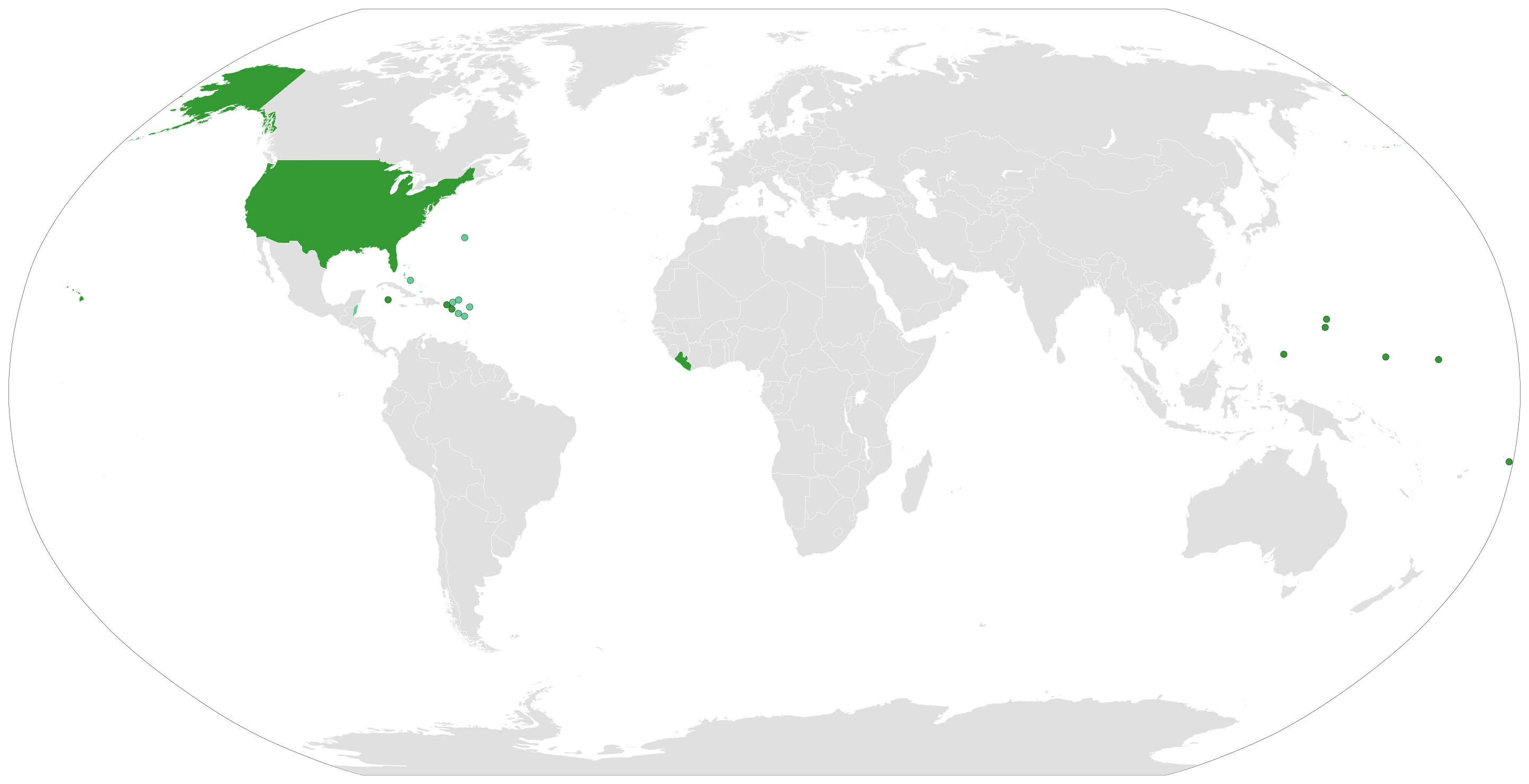
Countries that use Fahrenheit map
- Article(s)
https://en.wikipedia.org/wiki/Fahrenheit
- Request
Hello, I have never requested for a map to be edited, so I apologize if I break any norms or conventions.
The map I included is slightly incorrect, since the UK uses both Celsius and Fahrenheit, but it is only shown as using Celsius. To whomever might be reading this, please edit the map so the UK is shaded as light green, instead of light grey.
- Discussion
- It has been approximately three days since this was written. I don't mean to be impatient, but just out of curiosity, how long do these requests take to authorize and complete?
Unofficialwikicorrector (talk) 22:00, 27 September 2020 (UTC)
It has been over a week since I posted this request and it hasn't been enacted as yet. Could somebody at least give a response? Unofficialwikicorrector (talk) 15:14, 6 October 2020 (UTC)
Content Disclaimer
Informasi ini disarikan dari Wikipedia dan disajikan kembali untuk tujuan edukasi. Konten tersedia di bawah lisensi CC BY-SA 3.0. Kami tidak bertanggung jawab atas ketidakakuratan data yang bersumber dari kontribusi publik tersebut.
- The information displayed on this website is sourced in part or in whole from Wikipedia and has been adapted for the purpose of restating it. We strive to provide accurate and relevant information, however:
- There is no guarantee of absolute accuracy. Wikipedia is an open, collaborative project that can be edited by anyone, so information is subject to change.
- It is not intended to constitute professional advice. The content displayed is for informational and educational purposes only. For important decisions (e.g., medical, legal, or financial), please consult a professional.
- Content copyright. Wikipedia is licensed under the Creative Commons Attribution-ShareAlike License (CC BY-SA). This means that content may be reused with appropriate attribution and shared under a similar license.
- Responsible use. Any risk arising from the use of information from this website is entirely the responsibility of the user.