This is an archive of past discussions on Wikipedia:Graphics Lab, for the period 2025. Do not edit the contents of this page. If you wish to start a new discussion or revive an old one, please do so on the current main page.
On the article for the Antilles, the Lucayan Archipelago is highlighted in the map as it is a map for the West Indies. Could a seperate map with the Lucayan Archipelago be made to actually represent the Antilles as the current map is borderline misinformation. Also, I am reviewing the map and noticed that the Leeward Antilles is not included in the current map. Both maps probably should have it. ✶Quxyz✶ (talk) 13:42, 2 November 2025 (UTC)
Map of Sudan (1956–2011)
Hi, I'm looking for someone to create the Sudan grey–green orthographic map from 1956 to 2011.
The current map of visa requirements for South Sudanese citizens indicates that visas are required for the U.S., however since it was created, travel was banned by the U.S. government. This indicates that the U.S. should be coloured black rather than the current gray, as is done in the map for Israeli citizens for countries they are refused travel to. I have included both for reference.
Map of visa requirements for South Sudanese citizensVisa requirements for Israeli citizens
Those drafts are PNG versions of the original SVG file I'm working in and will upload to commons.
Those drafts are shown for proofreading only.
----
I have chosen to have the same background for all of the basins. One reason is so it will work for most people (also with color deficiencies), but also if there is different colors people can read in values depending on them.
@Goran tek-en Thank you. By “proofreading” did you mean just checking the text? That looks fine to me and as an svg it should be easy for native Turkish speakers to check and correct once I add it to a trwiki article. As a native English speaker I can easily use the svgtranslate tool to add English. On second thoughts please change "Konya Kapalı" to simply "Konya".
However I really feel we should have different colors. My vision is fairly normal and I can see the basin border lines, but without the different colors their shapes and sizes are not obvious. Whereas on map1 in https://water.fanack.com/turkey/water-resources-in-turkey/ it is easy to see, for example, how huge the Tigris-Euprates basin is. Probably you are younger than me. Please could you reconsider about colors.
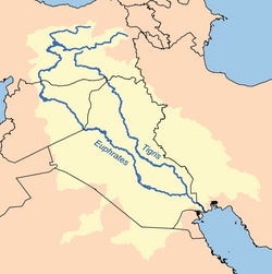
I forgot to ask whether the cross-border character of a few basins can be shown in some way. Çoruh, Aras, Tigris-Euprates, Asi, and in the west, Meriç. For example as you may know Tigris-Euprates (Fırat-Dicle in Turkish) is highly political so it would be nice to give the reader a clue that it extends into Iraq and Syria. Tigr-euph Perhaps it could be say green in Turkey and a lighter green in other countries? Or just hatch green a few km across? But if this is too difficult forget it. Chidgk1 (talk) 07:03, 2 January 2026 (UTC)
Proofreading: checking everything in the Draft. I have had occasions when people have taken those png's and uploaded those Drafts themselves which is not right so I state this.
I will be back with a new different colored draft but I will consider color deficiencies and that map is under copyright so I will not/can't just copy. I'm not probably younger than you if it matters.
You mention "Tigris-Euprates"as an extended basin, but we don't have one named like that.
Do you have any pas that show how they extend in the other countries.
@Goran tek-en For me I would be happy just to update the above “Turkey-ocm2.svg” but if so I had better do it so I can take any flak not you.
However if you prefer to upload it as a new map maybe call it “Turkey river basins” or whatever you prefer. I will only do the descriptions etc in English as that is my native language and my Turkish is poor.
Description: River basins of Turkey also showing where they extend into neighbouring countries
Caption: River basins of Turkey also showing where they extend into neighbouring countries
Categories: Drainage basin maps of Turkey, SVG maps of Turkey
@Goran tek-en Ah I just noticed a small detail which I hope you can correct. As you can see from the Fanack map the Marmara Basin does not quite reach the Greek nainland. This is because the land border mostly follows the Maritsa (Meriç in Turkish) River Chidgk1 (talk) 17:54, 6 January 2026 (UTC)
@Goran tek-en I just noticed something I ought to have spotted before. Occasionally on the map the streams or rivers are crossing from one basin to another whereas I don’t think that is possible naturally. For example between Kızılırmak and Batı Karadeniz, and Gediz and Susurluk - I don't blame you for that as I see it is also sometimes wrong on the Fanack map -perhaps deliberately to see if we are copying them!? The description above could be extended with "transfers not shown" or somesuch https://iwaponline.com/ws/article/25/4/696/107601/Assessing-the-future-water-potential-of-IstanbulChidgk1 (talk) 13:49, 7 January 2026 (UTC)
@Chidgk1 I had a quick look at it and someone (was it not you?) has done this so it should be possible. It's outside of graphic work but if you want me to try to fix it just tell me, thanks.
@Goran tek-en Thanks for all your hard work. I’ll put it in now and ask for comments from native speakers of Turkish. Let’s close off this request and if there any minor fixes needed I will batch them up with any enhancements into a new request maybe next month. Thanks again and I hope this will be useful for years to come Chidgk1 (talk) 12:01, 9 January 2026 (UTC)
The current map does not reflect any changes after March of 2025. Using the legend in the description, can you please shade in Colombia with the color that reflects the "Visa-free, 90 days" category. -- Anfecaro (talk) 22:51, 7 January 2026 (EST)
The current map does not reflect any changes after February of 2025. Using the legend in the description, can you please shade in Colombia, Dominica, Mozambique, São Tomé and Príncipe with the color that reflects the Visa not required (60 days) category. Additionally, can you create another color and add to legend for a Visa not required (30 days) category and color in Grenada using the new color. -- Anfecaro (talk) 22:49, 7 January 2026 (EST)
The current map does not reflect any changes after November of 2025. Using the legend in the description, can you please shade in Belarus and Ghana with the color for the "Visa not required" category. -- Anfecaro (talk) 22:49, 7 January 2026 (EST)
Informasi ini disarikan dari Wikipedia dan disajikan kembali untuk tujuan edukasi. Konten tersedia di bawah lisensi CC BY-SA 3.0. Kami tidak bertanggung jawab atas ketidakakuratan data yang bersumber dari kontribusi publik tersebut.
The information displayed on this website is sourced in part or in whole from Wikipedia and has been adapted for the purpose of restating it. We strive to provide accurate and relevant information, however:
There is no guarantee of absolute accuracy. Wikipedia is an open, collaborative project that can be edited by anyone, so information is subject to change.
It is not intended to constitute professional advice. The content displayed is for informational and educational purposes only. For important decisions (e.g., medical, legal, or financial), please consult a professional.
Content copyright. Wikipedia is licensed under the Creative Commons Attribution-ShareAlike License (CC BY-SA). This means that content may be reused with appropriate attribution and shared under a similar license.
Responsible use. Any risk arising from the use of information from this website is entirely the responsibility of the user.

.svg)


 . As you maybe know water shortages are a problem here so helping people understand is important I think. Chidgk1 (talk) 13:29, 11 December 2025 (UTC)

.svg)
 Request taken by Justin Kunimune (talk) 13:28, 11 January 2026 (UTC).
