Wikipedia:Graphics Lab/Map workshop/Archive/Feb 2026
| This is an archive of past discussions on Wikipedia:Graphics Lab, for the period 2026. Do not edit the contents of this page. If you wish to start a new discussion or revive an old one, please do so on the current main page. |
 | Archives of 2026:
January, February, March, April, May, June, July, August, September, October, November, December |
Typos on a color legend
-
 Global effects of the 1988–1992 revolutions

- Article(s)
- Request
Make the following typographical corrections:
- Socialims → Socialism
- Economical liberalization → Economic liberalization
- Startd → started
I would also suggest modifying the text in the legend so that it consistently uses sentence case.
- Discussion
– MrPersonHumanGuy (talk) 19:30, 18 January 2026 (UTC)
- If someone could list the country codes for each categories, I'd gladly redraw it as an SVG with editable text (and the misspellings fixed!) cmɢʟee τaʟκ (please add
{{ping|cmglee}}to your reply) 12:15, 1 February 2026 (UTC)
Could someone create a (vector?) map to replace the invalid use of a non-free map? JayCubby 17:38, 25 February 2026 (UTC)
- @JayCubby: wouldn't the maps at Maritime Delimitation in the Black Sea case help? M.Bitton (talk) 18:20, 25 February 2026 (UTC)
- @M.Bitton, good catch. No need to vectorize, the PNG is more than good enough. Many thanks. JayCubby 18:36, 25 February 2026 (UTC)
 This section is resolved and can be archived. If you disagree, replace this template with your comment. JayCubby 18:36, 25 February 2026 (UTC)
{{resolved}} Muaza Husni (talk) 04:20, 18 March 2026 (UTC)
Request: 1947 map of Liverpool Corporation Tramways
-
 1947 Liverpool Corporation Tramways geographic network map

- Article(s)
- Liverpool Corporation Tramways
- Request
- Map that is vectorized and with labels other than in Dutch (English) -- Darrelljon (talk) 13:20, 3 February 2026 (UTC)
- Discussion
Yemen

-
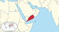
 Northern Yemen
 -
 Southern Yemen
 -
 Orthographic projection of Middle East in the 90's


- Article(s)
- South Yemen and Yemen Arab Republic.
- Request
- Hi. I need two svg orthographic projections for South Yemen and Yemen Arab Republic. Both should have etheir northern or southern Yemen in light green, as territory claimed. Like for Ba'athist Syria for example. CC @Abo Yemen:. -- Panam2014 (talk) 12:59, 10 January 2026 (UTC)
- Thanks for the ping. I would also like to request a map of South Yemen showing the w:Kamaran island being part of it, per w:South Yemen#Territorial changes 𐩣𐩫𐩧𐩨 Abo Yemen (𓃵) 13:02, 10 January 2026 (UTC)
- Source: NYT 𐩣𐩫𐩧𐩨 Abo Yemen (𓃵) 17:00, 12 January 2026 (UTC)
- Thanks for the ping. I would also like to request a map of South Yemen showing the w:Kamaran island being part of it, per w:South Yemen#Territorial changes 𐩣𐩫𐩧𐩨 Abo Yemen (𓃵) 13:02, 10 January 2026 (UTC)
- Discussion
- To avoid WP:CIRCULAR, I suggest listing reliable sources that show both territories. M.Bitton (talk) 16:41, 12 January 2026 (UTC)
- Hi @AAEexecutive, you'll need to place this under a separate request, as your map isn't relevant to this specific discussion. There are instructions at the top of the page on how to go about this.
- Best,
- CSGinger14 (talk) 18:05, 13 January 2026 (UTC)
- I reverted their edit. M.Bitton (talk) 18:21, 13 January 2026 (UTC)
- The misplaced message link. @AAEexecutive, I requested an SVG version at Wikimedia Commons: Commons Graphic lab link. I thought they may be more familiar with SVG language conversion. Commander Keane (talk) 03:19, 14 January 2026 (UTC)
- @Abo Yemen as you are presumably aware North/South Yemen's borders were always contested and often not properly defined or in a state of flux. What year's boundaries do you want? I have a number of sources:
- https://www.cia.gov/readingroom/docs/CIA-RDP85T00314R000100010001-0.pdf (p18)
- https://commons.wikimedia.org/wiki/File:South_Yemen-CIA_WFB_Map.png
- https://users.ox.ac.uk/~metheses/Ismail%20Thesis.pdf
- https://maps.lib.utexas.edu/maps/atlas_middle_east/yemen_divisions.jpg
- https://www.cia.gov/readingroom/docs/CIA-RDP89S01450R000500500001-7.pdf (p10)
- https://www.cia.gov/readingroom/docs/CIA-RDP88T00096R000800980002-6.pdf (p11)
- Arabian boundary disputes Schofield (vol 20)
- Saudi-Yemeni relations : domestic structures and foreign influence Gregory
- – Isochrone (talk) 00:11, 28 January 2026 (UTC)
- Hello @Isochrone, I actually need multiple maps from different eras (if you'd call them that). 1st map would be the one of the PRSY from 1967 till 1971, which controlled Kamaran and claimed the Khuriya Muriya Islands and Sharurah (see al-Wadiah War. The 2nd and 3rd maps would be of the territorial changes during the First and Second Yemenite Wars. The last one related to South Yemen (which we already have) would be the post-1979 map. As for the Yemen Arab Republic (North Yemen), a map of the NDF Rebellion is needed.A map of the FLOSY raids in South Yemen (future article that I'm planning on making) would be really cool to have. I saw a map of it before, but I forgot in which book it was. I'll start looking for it.Also, is it possible to have a map of the PFLOAG's greatest territorial control of Oman during the Dhofar rebellion? or do I start a new request? 𐩣𐩫𐩧𐩨 Abo Yemen (𓃵) 11:43, 29 January 2026 (UTC)
- @Abo Yemen you presumably understand that orthographic maps are designed for clearly identifiable regions and here it would perhaps be more appropriate for a normal map. Do you have any other sources than those I included? Would you like separate maps or one with all the boundaries superimposed and a legend? – Isochrone (talk) 20:31, 2 February 2026 (UTC)
- @Isochrone sorry for the late respose. It would be better for the maps to be separate. As for the source for the FLOSY raids, it is Arabia without Sultans by Fred Halliday, page 231 𐩣𐩫𐩧𐩨 Abo Yemen (𓃵) 11:48, 6 February 2026 (UTC)
- @Abo Yemen you presumably understand that orthographic maps are designed for clearly identifiable regions and here it would perhaps be more appropriate for a normal map. Do you have any other sources than those I included? Would you like separate maps or one with all the boundaries superimposed and a legend? – Isochrone (talk) 20:31, 2 February 2026 (UTC)
- Hello @Isochrone, I actually need multiple maps from different eras (if you'd call them that). 1st map would be the one of the PRSY from 1967 till 1971, which controlled Kamaran and claimed the Khuriya Muriya Islands and Sharurah (see al-Wadiah War. The 2nd and 3rd maps would be of the territorial changes during the First and Second Yemenite Wars. The last one related to South Yemen (which we already have) would be the post-1979 map. As for the Yemen Arab Republic (North Yemen), a map of the NDF Rebellion is needed.A map of the FLOSY raids in South Yemen (future article that I'm planning on making) would be really cool to have. I saw a map of it before, but I forgot in which book it was. I'll start looking for it.Also, is it possible to have a map of the PFLOAG's greatest territorial control of Oman during the Dhofar rebellion? or do I start a new request? 𐩣𐩫𐩧𐩨 Abo Yemen (𓃵) 11:43, 29 January 2026 (UTC)
- @Abo Yemen as you are presumably aware North/South Yemen's borders were always contested and often not properly defined or in a state of flux. What year's boundaries do you want? I have a number of sources:
- The misplaced message link. @AAEexecutive, I requested an SVG version at Wikimedia Commons: Commons Graphic lab link. I thought they may be more familiar with SVG language conversion. Commander Keane (talk) 03:19, 14 January 2026 (UTC)
- I reverted their edit. M.Bitton (talk) 18:21, 13 January 2026 (UTC)
Please separate Halabja from Sulaymaniyah if possible
-
 Map of Iraq's Governorates
 -


Article(s): Map featuring Iraq's Governorates:
- en:Politics of Iraq
- en:Governorates of Iraq
- en:Administrative divisions of Iraq
- en:Iraq
- en:Portal:Iraq/Governorates Image Map
- en:User:Kharbaan Ghaltaan/Iraq
- en:User:Kharbaan Ghaltaan/Iraq !!
Map containg the results of the 2024 Kurdistan Region results:
- Request
- Currently, if you download both of these two SVG images that I have provided, you would notice that the Halabja Governorate is actually apart of the Sulaymaniyah Governorate. Instead, I would like for Halabja to be separated from Sulaymaniyah and be distinct parts of each other in said SVG file.
- Do note that I copied this request from right here as I didn't see anybody comment on my request. I'm hoping that this time that someone would come here to actually fufill my suggestion on this one. GuesanLoyalist (talk) 12:39, 18 January 2026 (UTC)
- @Cmglee: you think you could do this? (Pinging you because I think you're a pretty good expert in SVGs, so you may able to split Halabja and Sulaymaniyah as separate. No pressure though) GuesanLoyalist (talk) 02:20, 4 February 2026 (UTC)
- @GuesanLoyalist: I can't quite understand what is requested. I see that the election results diagram has three territories from the northeast of the Governorates diagram. The southernmost one is labelled Al-Sulaymaniyah. I don't see any labelled Halabja. cmɢʟee τaʟκ (please add
{{ping|cmglee}}to your reply) 09:04, 4 February 2026 (UTC)- @Cmglee: Halabja is the small pocket-looking governorate (semi-similar to the border of the ACT I guess?), al-Sulaymaniyah (one of the names that sulaymaniyah is called) is the bigger neighboring governorate. Try going on https://upload.wikimedia.org/wikipedia/commons/e/e3/Iraqi_Governorates.svg to see it for yourself if you can.
- Also: If you download the SVG of both images and open it in a photo editing app, you should see that the border differentiating halabja from sulaymaniyah is a simple line, so please work on that one if possible
- That was orignally my request, but I have now figured it out on how to do it by myself, sorry for not responding to you earrier as I thought I had posted this comment to you. turns out I didn't unfortunately :(
- GuesanLoyalist (talk) 23:43, 5 February 2026 (UTC)
- @GuesanLoyalist: Glad you sorted it out. May I suggest thickening the discs' outlines (stroke) as the KDP discs are hard to see on Erbil as both have the same colour? cmɢʟee τaʟκ (please add
{{ping|cmglee}}to your reply) 01:37, 6 February 2026 (UTC)- @Cmglee: So the elected seats per governorate is what you're talking about? I'll do that if possible, I got that sorted! GuesanLoyalist (talk) 02:26, 6 February 2026 (UTC)
- @Cmglee Actually... I changed my mind on the seats thing, I like the current borders for said seats but to still try to fulfill your request, I've made the map borders more thicker then before. From 0.5px to 1px specifically. GuesanLoyalist (talk) 02:49, 6 February 2026 (UTC)
- @GuesanLoyalist: OK, it's your choice, just commenting that yellow circles on top of a yellow territory aren't very visible. Cheers, cmɢʟee τaʟκ (please add
{{ping|cmglee}}to your reply) 06:53, 6 February 2026 (UTC)
- @GuesanLoyalist: OK, it's your choice, just commenting that yellow circles on top of a yellow territory aren't very visible. Cheers, cmɢʟee τaʟκ (please add
- @Cmglee Actually... I changed my mind on the seats thing, I like the current borders for said seats but to still try to fulfill your request, I've made the map borders more thicker then before. From 0.5px to 1px specifically. GuesanLoyalist (talk) 02:49, 6 February 2026 (UTC)
- @Cmglee: So the elected seats per governorate is what you're talking about? I'll do that if possible, I got that sorted! GuesanLoyalist (talk) 02:26, 6 February 2026 (UTC)
- @GuesanLoyalist: Glad you sorted it out. May I suggest thickening the discs' outlines (stroke) as the KDP discs are hard to see on Erbil as both have the same colour? cmɢʟee τaʟκ (please add
- @GuesanLoyalist: I can't quite understand what is requested. I see that the election results diagram has three territories from the northeast of the Governorates diagram. The southernmost one is labelled Al-Sulaymaniyah. I don't see any labelled Halabja. cmɢʟee τaʟκ (please add
- @Cmglee: you think you could do this? (Pinging you because I think you're a pretty good expert in SVGs, so you may able to split Halabja and Sulaymaniyah as separate. No pressure though) GuesanLoyalist (talk) 02:20, 4 February 2026 (UTC)
![]() Bumping thread. GuesanLoyalist (talk) 06:09, 20 January 2026 (UTC)
Bumping thread. GuesanLoyalist (talk) 06:09, 20 January 2026 (UTC)
![]() Bumping thread. GuesanLoyalist (talk) 05:54, 27 January 2026 (UTC)
Bumping thread. GuesanLoyalist (talk) 05:54, 27 January 2026 (UTC)
![]() Bumping thread. GuesanLoyalist (talk) 00:58, 3 February 2026 (UTC)
Bumping thread. GuesanLoyalist (talk) 00:58, 3 February 2026 (UTC)
- Graphist opinion(s)
Macauley Island bathymetry
-
Bathymetry of Macauley Island
-
Map of Macauley Island with landforms
- Article(s)
- Macauley Island
- Request
- There is a bathymetric map here but I was never certain if the CC licence there actually applies to a work that is only partially NOAA's. Regarding the landforms, I think "de Lange, Peter J. (2015). "Recent vegetation succession and flora of Macauley Island, southern Kermadec Islands". Bulletin of the Auckland Museum (20): 207–230 – via ResearchGate" has some sources. -- Jo-Jo Eumerus (talk) 12:12, 4 February 2026 (UTC)
- Discussion
- The page states "This image is made available as a Public Domain Work" which means it's likely ok. Even if the data is proprietary, its depiction can be free, if released as public domain. cmɢʟee τaʟκ (please add
{{ping|cmglee}}to your reply) 01:46, 6 February 2026 (UTC)
Map of the County of Boulogne and Boulonnais estates in England
- Article(s)
- Eustace II of Boulogne, Eustace III of Boulogne, Matilda of Boulogne
- Request
- I would be very grateful for a map that shows the County of Boulogne and the County of Lens together with the Honour of Boulogne (estates in England belonging to the count of Boulogne). The source is the maps in Heather Tanner's Families, Friends and Allies: Boulogne and Politics in Northern France and England, c.879-1160. A part of her map of France can be seen here; I think it is about sufficient. Ideally the new map will contain the feudal subdivisions of France shown in this source map (but perhaps best omit the numbers denoting divisions outside the chosen part of the map). Here is the part of Tanner's map of England that contains the English estates. Surtsicna (talk) 14:03, 6 February 2026 (UTC)
- Discussion
Request
-
 Map of the Kazakh tribes in the 20th century.

- Article(s)
- Jüz
- Request
- Please add state and region boundary. -- Kaiyr (talk) 11:37, 12 February 2026 (UTC)
- Discussion
US Map
- Article(s)
- Pat Buchanan 2000 presidential campaign
- Pat Buchanan
- 2000 United States presidential election
- Third party (U.S. politics)
- Request
- I am just wondering can somebody make a US map for Percentage of vote received by Pat Buchanan in the 2000 presidential election by state or territory. The darker the color, the higher the %, the lower the % the less darker the color is. The color could be purple.
Here are the results State Vote percentage Votes Result Reference North Dakota 2.53 / 1007,288 Lost Alaska 1.82 / 1005,192 Lost Idaho 1.52 / 1007,615 Lost Montana 1.39 / 1005,697 Lost Wyoming 1.25 / 1002,724 Lost Utah 1.21 / 1009,319 Lost South Dakota 1.05 / 1003,322 Lost Minnesota 0.91 / 10022,166 Lost Arizona 0.81 / 10012,373 Lost Louisiana 0.81 / 10014,356 Lost Arkansas 0.80 / 1007,358 Lost Nevada 0.78 / 1004,747 Lost Indiana 0.77 / 10016,959 Lost Vermont 0.74 / 1002,192 Lost Oklahoma 0.73 / 1009,014 Lost Kansas 0.69 / 1007,370 Lost Maine 0.68 / 1004,443 Lost Colorado 0.60 / 10010,465 Lost Ohio 0.57 / 10026,724 Lost Rhode Island 0.56 / 1002,273 Lost Nebraska 0.52 / 1003,646 Lost West Virginia 0.49 / 1003,169 Lost New Hampshire 0.46 / 1002,615 Lost New York 0.46 / 10031,599 Lost Oregon 0.46 / 1007,063 Lost Iowa 0.44 / 1005,731 Lost Wisconsin 0.44 / 10011,471 Lost Georgia 0.42 / 10010,926 Lost Missouri 0.42 / 1009,818 Lost California 0.41 / 10044,987 Lost Massachusetts 0.41 / 10011,149 Lost Alabama 0.38 / 1006,351 Lost Illinois 0.34 / 10016,106 Lost Pennsylvania 0.34 / 10016,023 Lost Connecticut 0.32 / 1004,731 Lost North Carolina 0.30 / 1008,874 Lost Florida 0.29 / 10017,484 Lost Hawaii 0.29 / 1001,071 Lost Washington 0.29 / 1007,171 Lost Kentucky 0.27 / 1004,173 Lost South Carolina 0.25 / 1003,519 Lost Delaware 0.24 / 100777 Lost Mississippi 0.23 / 1002,265 Lost New Mexico 0.23 / 1001,392 Lost New Jersey 0.22 / 1006,989 Lost Maryland 0.21 / 1004,248 Lost Tennessee 0.20 / 1004,250 Lost Virginia 0.20 / 1005,455 Lost Texas 0.19 / 10012,394 Lost Michigan 0.04 / 1001,851 Lost
- Thanks.Muaza Husni (talk) 10:50, 7 February 2026 (UTC)
- Discussion
- @Muaza Husni: That would be perfect for my US choropleth template. Pinging @Timeshifter: cmɢʟee τaʟκ (please add
{{ping|cmglee}}to your reply) 17:06, 8 February 2026 (UTC)- @Muaza Husni: @Cmglee:
- See: c:User:Timeshifter/Sandbox 15
- Copy and paste that table (as is) into the map template as instructed here:
- c:File talk:Template map of US states and District of Columbia.svg/Instructions#Tips for pasting in a list fast
- --Timeshifter (talk) 08:52, 9 February 2026 (UTC)
- The map could be like this

Muaza Husni (talk) 11:13, 16 February 2026 (UTC)
- @Muaza Husni: There are various options. See:
- Commons:Map resources#Create SVG and PNG choropleth maps online for free. --Timeshifter (talk) 12:05, 16 February 2026 (UTC)
- I don't have the mind to learn how to make maps. I'm coming to this page to ask somebody who knows how to make the map.Muaza Husni (talk) 05:03, 22 February 2026 (UTC)
I don't have the time to do it, but maybe someone else does. The simplest choropleth map creator on that page is this one:
It provides the color codes, and so it easy to fill in the numbers that are needed for the legend. As with the John Kasich map:
{{legend|#76F8D4|0.0–9.9%|border=0}}
{{legend|#5CDEBA|10.0–19.9%|border=0}}
{{legend|#43C5A1|20.0–29.9%|border=0}}
{{legend|#29AB87|30.0–39.9%|border=0}}
{{legend|#038561|40.0–49.9%|border=0}}
{{legend|#006b47|50.0%+|border=0}}
--Timeshifter (talk) 13:08, 22 February 2026 (UTC)
- I just looked at the link you sent and I am totally lost on this. I don't know what i am looking at. You say its the simplest choropleth map creator. It doesn't look like that.
- You don't have to make the map Timeshifter if you don't want to do, but I hope somebody who can do it, can do it. Muaza Husni (talk) 13:21, 22 February 2026 (UTC)
- @Muaza Husni: I added some instructions here:
- Commons:Map resources#Create SVG and PNG choropleth maps online for free.
- --Timeshifter (talk) 16:10, 22 February 2026 (UTC)
- @Muaza Husni: Before making the map, please note the objections raised by @GeogSage: about such choropleth maps (and as far as I can tell, most maps on Wikipedia), namely, lack of an orientation marker, scale, projection used, source (on the map itself), and a conformant colour scheme. I've requested them to raise their objections on this page and commons:Commons:Graphic_Lab/Map_workshop to get community consensus. Cheers, cmɢʟee τaʟκ (please add
{{ping|cmglee}}to your reply) 19:03, 26 February 2026 (UTC) - @Cmglee:, Noted.Muaza Husni (talk) 10:13, 7 March 2026 (UTC)
- @Cmglee:, here are sources.[1][2] Muaza Husni (talk) 10:27, 7 March 2026 (UTC)

Vote percentage received by Pat Buchanan in the 2000 US presidential election by state or territory - @Muaza Husni: I've made you the map you requested using Timeshifter's latest version of the template. Is this what you wanted? cmɢʟee τaʟκ (please add
{{ping|cmglee}}to your reply) 18:25, 1 April 2026 (UTC) - @Cmglee: Yes, it looks like what i wanted. Thanks for making it. I thought nobody was going to make it. Thanks again for making it. have a nice week.Muaza Husni (talk) 02:28, 2 April 2026 (UTC)
- @Muaza Husni: my pleasure. And to you too! cmɢʟee τaʟκ (please add
{{ping|cmglee}}to your reply) 03:04, 2 April 2026 (UTC)
- @Muaza Husni: my pleasure. And to you too! cmɢʟee τaʟκ (please add
- @Muaza Husni: Before making the map, please note the objections raised by @GeogSage: about such choropleth maps (and as far as I can tell, most maps on Wikipedia), namely, lack of an orientation marker, scale, projection used, source (on the map itself), and a conformant colour scheme. I've requested them to raise their objections on this page and commons:Commons:Graphic_Lab/Map_workshop to get community consensus. Cheers, cmɢʟee τaʟκ (please add

{{ping|cmglee}} to your reply) 03:04, 2 April 2026 (UTC) Content Disclaimer
Informasi ini disarikan dari Wikipedia dan disajikan kembali untuk tujuan edukasi. Konten tersedia di bawah lisensi CC BY-SA 3.0. Kami tidak bertanggung jawab atas ketidakakuratan data yang bersumber dari kontribusi publik tersebut.
- The information displayed on this website is sourced in part or in whole from Wikipedia and has been adapted for the purpose of restating it. We strive to provide accurate and relevant information, however:
- There is no guarantee of absolute accuracy. Wikipedia is an open, collaborative project that can be edited by anyone, so information is subject to change.
- It is not intended to constitute professional advice. The content displayed is for informational and educational purposes only. For important decisions (e.g., medical, legal, or financial), please consult a professional.
- Content copyright. Wikipedia is licensed under the Creative Commons Attribution-ShareAlike License (CC BY-SA). This means that content may be reused with appropriate attribution and shared under a similar license.
- Responsible use. Any risk arising from the use of information from this website is entirely the responsibility of the user.