Baruth/Mark
Baruth/Mark | |
|---|---|
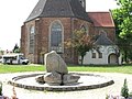
 Saint Sebastian parish church | |
 Coat of arms | |
Location of Baruth/Mark
within Teltow-Fläming district  | |
 Location of Baruth/Mark | |
 Baruth/Mark  Baruth/Mark | |
| Coordinates: 52°03′N 13°30′E / 52.050°N 13.500°E | |
| Country | Germany |
| State | Brandenburg |
| District | Teltow-Fläming |
| Subdivisions | 12 Ortsteile bzw. Stadtbezirke |
| Government | |
| • Mayor (2018–26) | Peter Ilk[1] |
| Area | |
• Total | 233.83 km2 (90.28 sq mi) |
| Highest elevation | 145 m (476 ft) |
| Lowest elevation | 51 m (167 ft) |
| Population (2024-12-31)[2] | |
• Total | 4,168 |
| • Density | 17.82/km2 (46.17/sq mi) |
| Time zone | UTC+01:00 (CET) |
| • Summer (DST) | UTC+02:00 (CEST) |
| Postal codes | 15837 |
| Dialling codes | 033704 |
| Vehicle registration | TF |
| Website | www.stadt-baruth-mark.de |
Baruth/Mark (German pronunciation: [ˈbaːʁuːt]) is a town in the Teltow-Fläming district of Brandenburg, Germany. It is situated 24 km east of Luckenwalde, and 53 km south of Berlin.
Geography
Baruth/Mark is structured in the following parts of town,[3] which are all villages and mainly former municipalities:
- Baruth/Mark
- Klein Ziescht
- Dornswalde
- Groß Ziescht
- Kemlitz
- Horstwalde
- Klasdorf
- Glashütte
- Ließen
- Merzdorf
- Mückendorf
- Paplitz
- Petkus
- Charlottenfelde
- Radeland
- Schöbendorf
Demography
-
 Development of Population since 1875 within the Current Boundaries (Blue Line: Population; Dotted Line: Comparison to Population Development of Brandenburg state; Grey Background: Time of Nazi rule; Red Background: Time of Communist rule)
 -
 Recent Population Development and Projections (Population Development before Census 2011 (blue line); Recent Population Development according to the Census in Germany in 2011 (blue bordered line); Official projections for 2005-2030 (yellow line); for 2017-2030 (scarlet line); for 2020-2030 (green line)


Baruth/Mark: Population development within the current boundaries (2020)[4] | ||||||||||||||||||||||||||||||||||||||||||||||||||||||||||||||||||||||||||
|
|
| ||||||||||||||||||||||||||||||||||||||||||||||||||||||||||||||||||||||||
Climate
| Climate data for Baruth (1991–2020 normals) | |||||||||||||
|---|---|---|---|---|---|---|---|---|---|---|---|---|---|
| Month | Jan | Feb | Mar | Apr | May | Jun | Jul | Aug | Sep | Oct | Nov | Dec | Year |
| Mean daily maximum °C (°F) | 3.5 (38.3) |
5.4 (41.7) |
9.5 (49.1) |
16.0 (60.8) |
20.4 (68.7) |
24.0 (75.2) |
25.7 (78.3) |
25.0 (77.0) |
20.5 (68.9) |
14.6 (58.3) |
8.7 (47.7) |
4.7 (40.5) |
14.8 (58.6) |
| Daily mean °C (°F) | 0.8 (33.4) |
1.8 (35.2) |
4.5 (40.1) |
9.5 (49.1) |
14.0 (57.2) |
17.5 (63.5) |
19.4 (66.9) |
18.5 (65.3) |
14.4 (57.9) |
9.7 (49.5) |
5.4 (41.7) |
2.3 (36.1) |
9.9 (49.8) |
| Mean daily minimum °C (°F) | −2.4 (27.7) |
−1.9 (28.6) |
−0.4 (31.3) |
2.4 (36.3) |
6.6 (43.9) |
10.3 (50.5) |
12.6 (54.7) |
11.8 (53.2) |
8.3 (46.9) |
5.0 (41.0) |
1.8 (35.2) |
−0.8 (30.6) |
4.4 (39.9) |
| Average precipitation mm (inches) | 42.7 (1.68) |
32.6 (1.28) |
38.3 (1.51) |
29.6 (1.17) |
53.1 (2.09) |
50.4 (1.98) |
79.1 (3.11) |
58.0 (2.28) |
45.1 (1.78) |
40.5 (1.59) |
43.1 (1.70) |
41.6 (1.64) |
558.7 (22.00) |
| Average precipitation days (≥ 0.1 mm) | 16.3 | 14.0 | 15.0 | 10.9 | 12.6 | 13.1 | 13.3 | 12.6 | 11.6 | 13.3 | 14.8 | 16.8 | 164.0 |
| Average relative humidity (%) | 85.1 | 81.0 | 75.9 | 68.0 | 67.4 | 67.6 | 69.0 | 71.1 | 76.4 | 82.9 | 87.1 | 85.9 | 76.3 |
| Mean monthly sunshine hours | 54.7 | 78.5 | 128.0 | 200.8 | 223.3 | 228.0 | 234.3 | 218.8 | 174.1 | 115.8 | 64.6 | 48.9 | 1,814.2 |
| Source: NOAA[5] | |||||||||||||
Photogallery
-
 Street sign on entry to Baruth/Mark
 -
 Firehouse
 -
 Castle Baruth
 -
 Fascia detail, Castle Baruth
 -
 Cathedral
 -
 Municipal Playground


Sons and daughters of the town

- Christian Kunth (1757-1829), educator, educator of Alexander and Wilhelm von Humboldt
- Johann Gottlob Nathusius (1760-1835), entrepreneur
- Johann Georg Lehmann (1765-1811), surveyor and cartographer
- Friedrich zu Solms-Baruth (1795-1879), politician, member of Prussian parliament
- Ewald von Lochow (1855-1942), Prussian general
- Feodora Schenk (1920-2006), German athlete
References
- ^ Landkreis Teltow-Fläming Wahl der Bürgermeisterin / des Bürgermeisters Archived 2021-07-09 at the Wayback Machine, accessed 4 July 2021.
- ^ "Bevölkerungsstand im Land Brandenburg Dezember 2024 (Fortgeschriebene amtliche Einwohnerzahlen, basierend auf dem Zensus 2023)" (XLS). Amt für Statistik Berlin-Brandenburg (in German).
- ^ Main constitution of the town of Baruth/Mark PDF[permanent dead link] (in German)
- ^ Detailed data sources are to be found in the Wikimedia Commons.Population Projection Brandenburg at Wikimedia Commons
- ^ "Baruth Climate Normals 1991–2020". National Oceanic and Atmospheric Administration. Archived from the original on 14 September 2023. Retrieved 15 September 2023.
Towns and municipalities in Teltow-Fläming | ||
|---|---|---|
 | ||
| International | |
|---|---|
| Other | |
This Brandenburg location article is a stub. You can help Wikipedia by adding missing information. |
Content Disclaimer
Informasi ini disarikan dari Wikipedia dan disajikan kembali untuk tujuan edukasi. Konten tersedia di bawah lisensi CC BY-SA 3.0. Kami tidak bertanggung jawab atas ketidakakuratan data yang bersumber dari kontribusi publik tersebut.
- The information displayed on this website is sourced in part or in whole from Wikipedia and has been adapted for the purpose of restating it. We strive to provide accurate and relevant information, however:
- There is no guarantee of absolute accuracy. Wikipedia is an open, collaborative project that can be edited by anyone, so information is subject to change.
- It is not intended to constitute professional advice. The content displayed is for informational and educational purposes only. For important decisions (e.g., medical, legal, or financial), please consult a professional.
- Content copyright. Wikipedia is licensed under the Creative Commons Attribution-ShareAlike License (CC BY-SA). This means that content may be reused with appropriate attribution and shared under a similar license.
- Responsible use. Any risk arising from the use of information from this website is entirely the responsibility of the user.